

An Overview of the Siwa Oasis in Egypt
Part I: Geology and Geography
by John Watson
The Siwa Oasis must seem very mysterious to us, even though today it is slowly becoming more of a tourist destination. It has its own airport now, and is sometimes visited more for a few health resorts located there than for its antiquities. Nevertheless, it is certainly off the beaten path, or at least the antiquity path forged by the Nile River, and so it may never become a mainstream tourist destination. It remains one of Egypt's most isolated desert oases, and therefore it has today, as it always has had, a unique and interesting culture, as well as a fascinating history.

Even though the Siwa Oasis may ever receive the millions of tourists that visit Giza or Luxor, it is nevertheless famous for one specific reason, at least to those interested in history. It was here that Alexander the Great traveled to consult the Oracle of Amun, and there to be confirmed as God and King of Egypt.

In fact, the reason why this oracle was so important to him remains somewhat unclear, but go there he did. He continued to correspond with the Oracle of Amun until his death through messengers when he needed answers to important questions.
Most of the antiquities of the Siwa are now gone, many victims to illegal treasure hunters, though others succumbed to the harshness of time combined with the desert. Still, tourism is growing here, and if one is going to take the trouble of going out of their way to see this very different part of Egypt, some background information on the geography, geology, people and customs may be very useful.
The Geology of the Siwa
The Siwa sits in a depression, as do most of the oases, which today is frequently referred to as the Siwa depression. The depression is 82 kilometers (52 miles) long and between 9 and 28 kilometers wide.
This is the most distant Egyptian oasis from the Nile Valley.
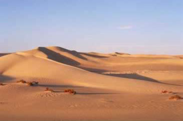
The southern parts of the Oasis have succumbed to dunes from the Great Sand Sea, which extends over 500 kilometers north to south and 60 to 80 kilometers east to west. The Siwa sits at the northwest edge of this Great Sand Sea. There are portions of the Siwa Depression that lie as much as 60 meters (192 feet) below sea level, but its average depth is 18 meters below sea level.

Salt is a problem in the Oasis. A number of its fresh water springs run into salt water lakes, making the water mostly useless. To the west is Birket al-Maraqi, which takes up about nine square kilometers, and the largest of the Siwa lakes, Birket Siwa, which covers about 32 square kilometers. To the east, the only remaining lakes are Birket Azmuri, which itself is often dry, and Birket Zaytun, a lake covering some 16 square kilometers. These lakes are so salty that no marine life survives, and there is no tradition of fishing in the oasis. Both the British and, more recently, the Egyptian governments attempted to introduce fish into the lakes in order to create a fishing industry, but still no one fishes. Some of the lakes are so salty that crystals are visible in the water.
Interestingly, one of the lakes, though not necessarily one of the modern ones, for there are others that are now completely dry, is legendary, though the stories varies. Depending on who tells the tale, on an island in this magic lake is buried either the saber and seal of the Prophet Mohammed, or the ring, sword and crown of King Solomon. Another fable records an apparent treasure on an island in Lake Arachie. The French secret agent, Boutin, transported his own collapsible canvas boat through the desert in an attempt to discover it, but the Siwans would not let him search. Later, in the 1920s, Byron Khun de Prorok did make it to the island, but discovered only evidence of human habitation,and no treasure.

These lakes are mostly fed by springs. There is plenty of water in the Oasis, with some 1,000 springs currently in use, but even the spring water has an elevated level of salt and is not good for watering many types of crops. Therefore, the Siwans are limited mostly to growing dates, olives and a few vegetables. The salty soil of the Oasis is called karshif in Arabic, and ererig by the Siwans. It is used by the locals to build their traditional mudbrick houses, which creates another problem. While the salt helps strengthen the walls of the houses, it also is unhealthy, and melts in the rain, making the houses potential death traps. While Siwa does not receive much rain, it doesn't take much to destroy these homes. In 1928, a major storm resulted in the local inhabitants abandoning their ancient town. These days, there are more and more prefab houses in the area. There are also some three thousand mountains and hills in the oasis. Many of them may have no names, but the four most important mountains are Gebel al-Mawta, Gebel al-Dakrur (Daran Breek, Bayle St. John's Edrar Abou Bryk), Gebel Hamra and Gebel Baylin (Adrar al-Milal, Edrar Amelal in Siwan, Mount Khamisa, Gebel Ghaffir). These mountains are riddled with caves, which were sometimes used as tombs, and at times inhabited both in antiquity and during more modern times. Though there is no evidence of it today, Arab historians also tell of great mines in Siwa where iron, lapis lazuli and emeralds were excavated.

We also should note several other small oases nearby the Siwa. In the 1970s, Apollo-Soyuz discovered from space a small depression only sixteen kilometers east of Siwa that no one seemed to know anything about. It was investigated and found to be uninhabited, but in many ways resembling the Siwa Oasis. It contained weathered land forms, natural bridges and conical hills. Otherwise, to the east, the nearest small oases to Siwa is al-'Areg, lying some 55 kilometers away, where there are several flowing springs. At one time clearly inhabited, as evidenced by rock cut tombs, today it is also uninhabited.

A map of the Siwa Oasis in Egypt
There are many desert paths that lead in to and out of the Siwa, but most of them remain inaccessible by modern vehicles. All of these tracks wind through passes in the escarpment, though most are not really clearly visible. The passes through which these tracks pass are known as Naqbs. Beginning in the northwest, the major ones are called Naqb Sharik, Naqb Mazura (Pass of the Measure), Naqb Qirba (Pass of the Waterskin), Naqb Migahhiz (Pass that is Prepared), Naqb Abu Beiraq (Pass of the Banner), Naqb al-Baqar (Pass of the Cow, Naqb al-Mughbara, Naqb al-Barn (Pass of the Horn) and Naqb Tibaghburgh (Pass of Bubbling Water). The Geography of the Siwa In the Siwa Oasis, the actual desert tracks are called Masrabs, rather than darbs, as they are called in other desert oases. Though there are many such tracks, there are a number of them that are more primary. Beginning in the northwest, Masrab al-Ikhan, the Road of the Brothers named for the Sanusi, begins at Bahag al-Din, where is separates form the main route to the west. It ascends through the escarpment at Naqb Sharik and then leads on to the Jaghbub Oasis in

Libya, before turning north and heading to the Libyan Coast. Masrab al-Rukhba also begins at Bahaq al-Din, but then leads north and climbs through the Naqb Mazuha. This path then drops back into the depression and joins the Masrab al-Ikhwan. These two tracks sometimes collectively known as the Masrab Haramiya, or Thieves' Roads, were actually the major routes between Egypt and Libya, and were among the most traveled in the Western Desert during the late nineteenth and early twentieth centuries. They were the routes of the Sanusi, and in fact, the routes began in Cairo or Alexandria, worked their way through Wadi Natrun or the northern coast across Qattara through Qara, and into the Siwa. After passing by the Siwa and through the Jaghbub Oasis, they then crossed through Kufra and Zuila, where they joined the north-south slave routes going north to Tripoli or south to Lake Chad. Just north of Zuila, the road is paved with what might be Roman milestones. There are also several tracks to Sallum on Egypt's north coast bordering Libya. The first is Masrab al-Shaqqa, which is also sometimes known as the Masrab Diqnash. This path runs for 310 kilometers, beginning in the western section of the depression. It runs over the escarpment and then turns due north to Sallum. The second one is Masrab Sheferzen, which cuts off from the main road, which is the Masrab al-Istabl, north of Siwa. Two other roads, known as the AMasrab al-Khamsa, or Road of the Five (because there were five wells along the path), and Massrab al-Qatrani, known as the Road of Tar, both go to Sidi Barrani on the north coast of Egypt. Most people heading to the Siwa probably take the most important route, known as the Masrab al-Istabl, or Stable Road (also known as the Sikket al-Sultan, or the Sultan's Path).

It begins along the northern coast at Mersa Matruh, and travels south by way of Wadi al-Raml, Bir Gueifire and the Naqb al-Hanayis to the halfway point called Bir Fuad al-Awwal, or Bir al-Nuss. From there, it continues south to Ras al-Hamraya, and enters the depression at Naqb Migahhiz. This was one of the routes taken by Alexander the Great in 331 BC, and it was used in this century by the famous visits of Kings Fuad I and Farouk. It took Alexander the Great eight days to travel this road, but it now takes only three or four hours by car. However, during the wet season, it can remain a bit difficult because water gathers on the road. East of the Masrab al-Istabl, the Masrab al-Naga departs the Siwa at Naqb al-Baqar, and joins the Masrab al-Istabl in the north, while the Masrab Dal exits Siwa at Naqb al-Mughbara and follows it own path north to Mersa Matruh.
Along the way, another path cuts south to join Masrab Khidida to the Qara Oasis, while further along the track, another path cuts northwest and leads to Gazalah on the coast. Also, on the eastern edge of the oasis, Masrab Khidida climbs its way out of the depression and heads toward the Qara Oasis by way of Naqb Abyad, Naqb al-Ahmar and Naqb Khamsa. After passing through Qara it then leads to Gazalah. Another famous route, and one that some travelers like to use today, though it is highly controlled by the military, is the Masrab Bahariya, which links this oasis with the Bahariya Oasis (where it is called Darb Siwa. The reason people like this road is because it travels through the Areg, Bahrein and Sitra Oasis, where some ruins can be found (particularly at Areg). It runs about 300 kilometers, and was only recently paved. Within the Oasis The main city in the Siwa is the city of Siwa itself, where most of the inhabitants of the Oasis live. The ancient city was Aghurmi, which is to the north of the modern one, while just to the south of the modern city center is Shali, a more recent fortified town built with only three gates, probably in about 1203 AD.

There are also other small districts and villages within the Siwa, most of which run along the main tracks to the Bahariya Oasis on the northern side of Birket Zaytun and along the road leading around Birket Siwa that eventually branches off at Bahaj al-Din into Masrab al-Rukhba. Along the latter road, leading east are Gahayba, Gari, Maraqi, Balad al Rum and Bahaj al-Din. To the south, above Birket Zaytun, leading east are Quruyshat, Avu Shuru and Zaytun. The area in the western part of the Oasis around Gari and Gahayba is some of the most fertile parts of the Siwa, with the best olive gardens and other crops, while nearer to Balad al-Rum is also good, but known more for its pasture land. However, the gardens around Al-Zaytun are the most famous of the oases, and probably the richest.

These gardens were once given to the head of the Sanusi order, but are now farmed by others. The geology of the Siwa Oasis is interesting, while the geography is complicated. Part of the problem is that the local inhabitants call most local landmarks by different names than are often used by cartographers like Ball and Beadnell, who mapped the Western Desert early in the 1900s. However, we will be using our geography to identify the location of various ancient sites in future articles on Tour Egypt.
Resources:
| Title | Author | Date | Publisher | Reference Number |
| Dictionary of Ancient Egypt, The | Shaw, Ian; Nicholson, Paul | 1995 | Harry N. Abrams, Inc., Publishers | ISBN 0-8109-3225-3 |
| Siwa Oasis | Fakhry, Ahmed | 2004 | American University of Cairo Press | ISBN 977 424 123 1 |
| Western Desert of Egypt, The | Vivian, Cassandra | 2000 | American University in Cairo Press, The | ISBN 977 424 527 X |
Last Updated: June 12th, 2011